 Paria Canyon, considered by just about every "Top Ten" list and publication in the backpacking world to be one of the best hikes in the country. 40 miles through a gorgeous canyon, including multiple crossings of deep, cold water. And hundreds of crossings, it would turn out, of shallow, cold water. It is a "non-technical" canyon hike, meaning it does not require special skills like rapelling. It really just requires common sense, so if you have read previous posts you know we were immediately at a disadvantage. I tried to procure a trail map and/or description, but discovered there was really no such thing, as the activity of the river through the canyon changed the trail drastically year-to-year, even often month-to-month. The basic gist was: Just follow the river. That seemed simple enough, even for us. The "us" on this adventure being Karin and I, who, if SURVIVAL is the one and only standard of measurement, have proven ourselves to be very capable outdoorswomen. Also along on this particular adventure was Karin's dog Riley, who walks around puddles after a rain, but is otherwise very outdoorsy.
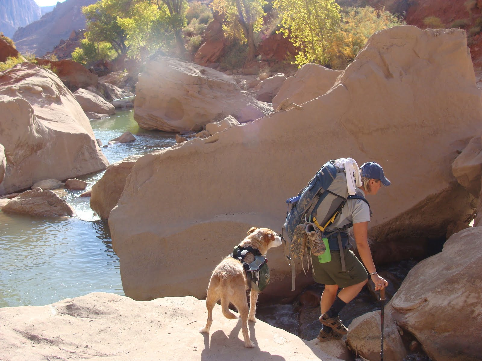
Ah, the beginning! So adventurous, so naive, so excited! SO CLEAN!


First mud bath of the trip. Turns out it is hard to get out of the mud without getting dirtier.
 |
| Sorry Riley, you cant walk around this puddle. |
 |
| And you can't climb that wall! |
 |
| You're gonna have to swim! |


Including Riley.
Although we never had trouble navigating the "trail," since there was only one option, the problem with not having a trail description was that we never knew how far along we were on our journey. On the second day we met some people hiking out, and they kindly gave us their printed trail description. We were thrilled to finally have some frame of reference. It turned out to be just about useless. There were references to things like CRACK 1 and 1ST SPRING. If during a 40 mile hike through a canyon you can differentiate between CRACK 1 and EVERY OTHER CRACK you are a better hiker than I. 1st, 2nd and 3rd Springs remain a mystery. At one point we saw water dripping from some moss on a wall. Was this 1st Spring?


Another "puddle" to cross. Karin tests the depth for a crossing.

It was too deep to walk through with our packs on, so we tied them in plastic bags and floated them across. As you can probably tell by Karin's face, the water is COLD.

Navigation got more difficult as the canyon filled with boulders and deep pools. It became a matter of boulder hopping across the pools and waterfalls and around the edges.


Days of walking in wet shoes and socks took their toll on Karin's blister-prone feet.

By the fourth day we were losing steam. We figured we had 12-14 miles left to go and we had gone the same distance the day before. We thought every bend would bring us out of the canyon and give us a glimpse of the end, but every turn revealed more of the same. We were boulder hopping around pools, then hiking up and along ridges to get around the river. Eventually the terrain opened up and we had to hike cross country while trying to keep an eye on the river, which was meandering all over by this point.

Trying to keep poor exhausted Riley's spirits up.

This is the trail registry that marks the end of the trail (the beginning if you go the other way). I spotted this sticking out of the ground from several hundred yards away and broke into a dead run, with my pack on, so overcome was I with pure joy and unfathomable relief that the end was in sight. As we had dragged ourselves the last few miles, not knowing when it would end, Karin and I had been asking, "Why do we do this to ourselves?" When I saw that registry that marked the end (actually it was another mile to our car) I had my answer. Without the 40 miles of slogging through the canyon, we would not have felt the pure, unadulterated joy that washed over us when the end came into view.

After Riley walked 40 miles off-leash, roaming with total freedom for four days, as soon as we pulled out his leash when we reached the main road he went wild with excitement because he was going to go for a walk!


